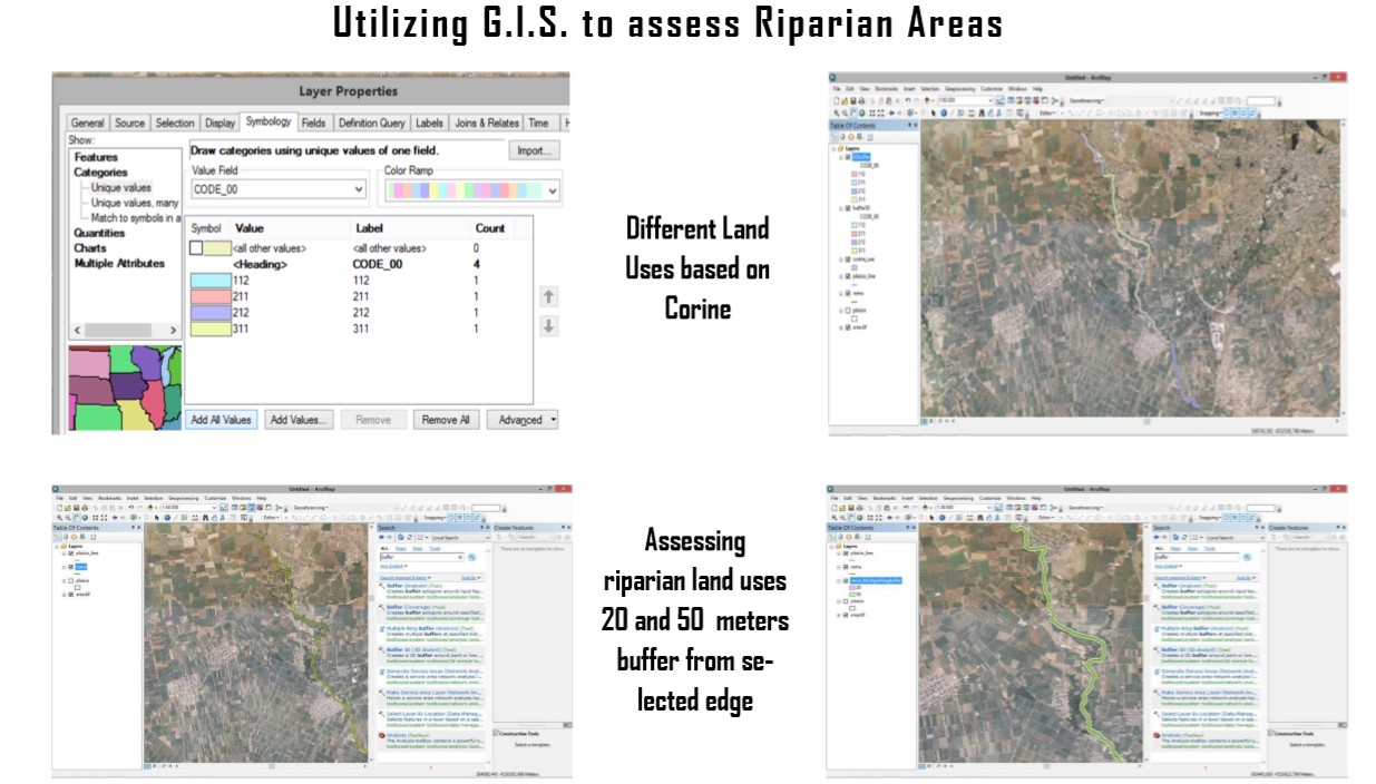
VISUAL PROTOCOL AND GIS AS PRELIMINARY INVESTIGATIVE TOOLS FOR STREAMS AND RIPARIAN AREAS

The conservation and protection of riparian areas is a worldwide priority. The main reason is because humans have utilized riparian areas for thousands of years for agricultural or urbanization purposes. Establishing tools that quickly and accurately assess these areas that can help make proper management decision is the objective of this study. Specifically, the visual protocol of “Stream Visual Assessment Protocol (SVAP)”, along with the buffer function of the Geographic Information System (GIS) were utilized and evaluated. The SVAP was developed in the United States and is a "rapid assessment protocol" that provides a quick, visual and systematic assessment of these natural ecosystems without interfering and altering them. This protocol has been applied in many regions and the version used has been modified for the Greek environment.  

GIS was used to estimate the land-uses of the ripar ian areas and is a program that integrates, stores, analyzes and presents geographic correlated data. These two tools were applied in Aggitis stream and its adjacent riparian areas that flows through the Drama Prefecture in Northern Greece. It is well known in the region because of a cave that the stream runs through, but also because it has a unique riparian forest. Lately, visitation has increased along the stream and the cave that has led to concerns that the stream and its riparian areas could be degraded if a sustainable management plan is not developed. This has made it imperative to assess the current condition along Aggitis stream. Both tools indicate degraded stream and riparian conditions with ecoengineering methods recommend improving the Aggitis ecosystem’s integrity.
 
VISUAL PROTOCOL AND GIS


Cookies

This site uses cookies to offer you a better browsing experience